Posted on 2/18/2020

Home Sweet Sandy Home--Life on a Barrier Island

Section of an 1822 map of coastal North Carolina showing three inlets that no longer exist, and no inlets where two are now located.

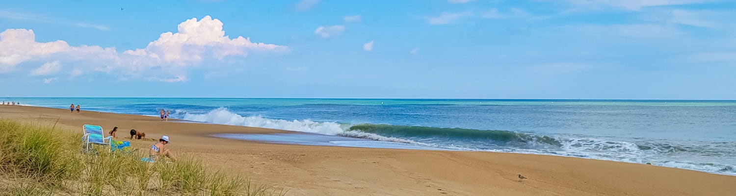
Welcome to the Outer Banks where, as the saying goes, we live on island time...except we don't really live on islands. More like sandbars that have managed to rise from the sea. 

That really is what a barrier island is and the Outer Banks are barrier islands and like all barrier islands they are not a permanent land mass. Left to their own devices, barrier islands migrate, generally to the shore.

The process is well documented. A large storm overwashes the sandbar. Sand is picked up from the ocean side and deposited on the landward or estuary side. 

The evidence of that process can be clearly seen if you know what to look for.

Where the Inlets Lived

On barrier islands, inlets open and close all the time and as they do so they leave a very clear footprint of where they have been.

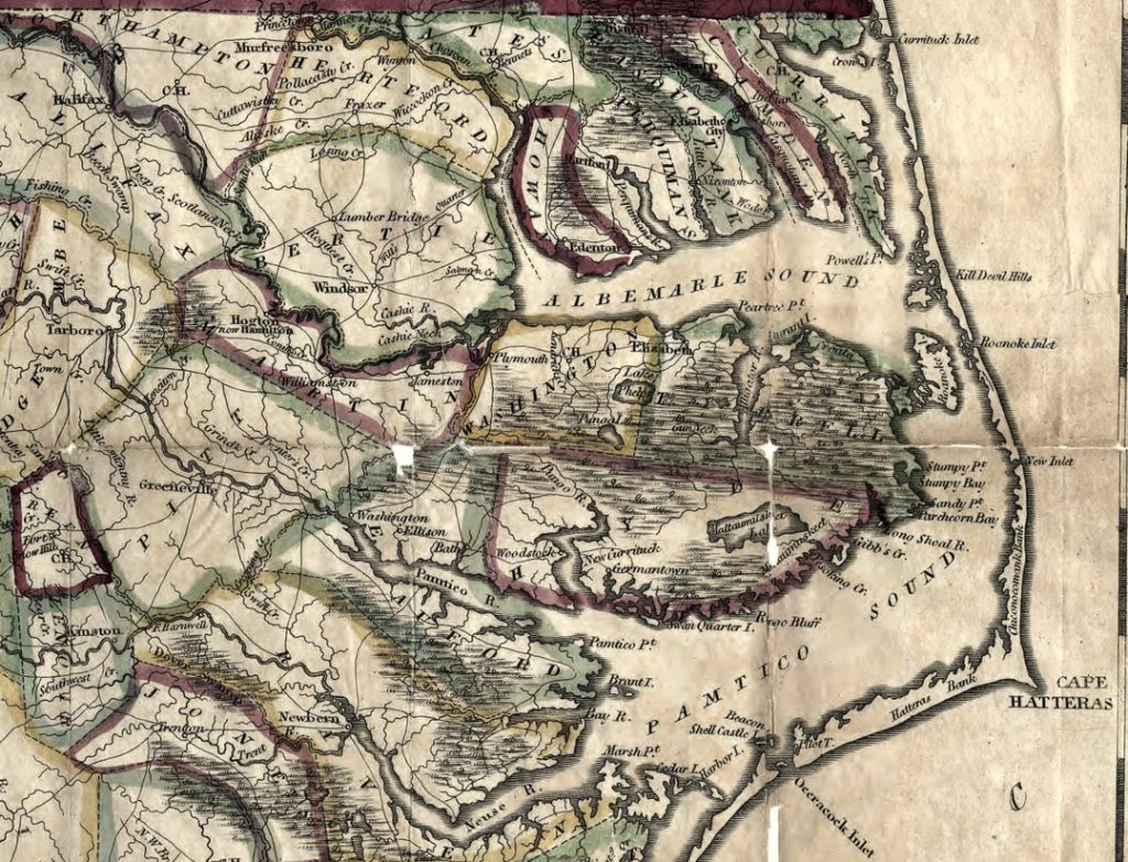
At the north end of Duck, looking out across Currituck Sound, the water is dotted with small muddy islands. That is the remnants of Caffey's Inlet that was open from about 1770-1811. The small islands are sand deposits from when the inlet was open.

More evidence? Check out the whole north end of Currituck Sound.

Currituck Inlet was so well known and so well defined that at one time the fledgling US Government established a customs house at what is now the town of Currituck. The customs house closed in 1828, as did Currituck Inlet.

The process continues to this day.

On Pea Island, in 2011 Hurricane Irene opened a passage to the sea that has historically been an inlet. The area is called New Inlet and since it was first noted by European explores in 1656 it has spent far more time open than closed.

Nonetheless, the processes that allow for the ocean to overwash the sandbars and move the Outer Banks to the west have been dramatically slowed by human intervention. 

Although the Outer Banks are barrier islands, there are a couple of true islands that are a part of what is typically included in a description of the area. It should be noted, though, that they are not directly on the shoreline.

Two Real Islands

Roanoke Island, where the Lost Colony tried their luck in the 1580s is now the home of Manteo and the fishing village of Wanchese. It's unlike any other island in the Outer Banks area.

It was probably an island before the Outer Banks formed some 10,000 or 12,000 years ago. Geologists how have looked at its history feel there were rivers that flowed northward toward what was at one time the Roanoke River Delta. At that time the eastern shore of the Untied States was at least 40-50 miles to the east.

Roanoke Island's nearest island neighbor is Colington Island about four miles north across Roanoke Sound.

Colington Island, at the end of the road that goes by the Wright Brothers Monument in Kill Devil Hills, is mostly a residential area. It actually is much more similar to the Outer Banks than Roanoke in a lot of ways.

It is actually a series of relict dunes, so it was probably either part of the coastline at one point or very close to it. The soil of the island is very sandy in keeping with its geological history.

Because it was once part of the shoreline and is made up of once upon a time dunes, the terrain is far more varied than Roanoke Island, which is pretty flat.

Interesting little fact—Roanoke Island was the first attempt by the English to colonize North Carolina. Colington Island was the first permanent settlement—1663.

Roanoke island and Colington are fairly close to one another, and for the most part, especially in the northern Outer Banks, things are clustered fairly close together. There is an exception to that though.

Hatteras Island Farthest From Mainland

Very few, if any, barrier islands are as far from the mainland as is Hatteras Island. It's so far across Pamlico Sound—18-20 miles—that one European explorer Giovanni da Verrazzano first entered it in 1529, he thought he had discovered a passage to the Pacific Ocean.

He probably didn't sail too far into the sound. If he had, no doubt he would have noticed that the waters were just too shallow to be an ocean. The maximum depth of Pamlico Sound is only 26'.

There is so much to explore and learn about the Outer Banks that it could be the study of a lifetime. Spend a week or so with Joe Lamb Jr. & Associates and begin your journey of discovery.